A developer came to us last year with a five-story mixed-use project planned along Ocean Boulevard. The structural engineer needed a site-specific ground motion parameter, not the default assumptions—because the IBC and ASCE 7-22 require a measured VS30 value for Site Class determination. The subsurface profile beneath that lot was a mix of alluvial sands and silts, typical for the Long Beach area, and a deep borehole alone would not capture the dynamic stiffness across the upper 30 meters. We deployed a 24-channel MASW array across the parcel. The survey mapped shear wave velocities from roughly 180 m/s in the shallow fill to over 450 m/s in the denser deposits below. That VS30 measurement moved the site classification from a conservative Site D assumption to a verified Site C boundary, which directly reduced the seismic base shear in the lateral analysis. This is why Long Beach engineers bring us in early—the difference between an assumed VS30 and a field-measured one can reshape the structural budget. When the seismic microzonation report needs ground truth data, the MASW results become the anchor point for the entire dynamic model.
A field-measured VS30 profile in Long Beach often reclassifies a site from D to C under IBC Chapter 16, reducing the seismic design forces by 15 to 20 percent.
How we work
The subsurface contrast between a site near the Los Angeles River channel and one up on Signal Hill is significant—and it directly affects how we configure the MASW spread. Down in the flatlands, where the water table sits at roughly 10 to 15 feet, the saturated fine sands can slow the Rayleigh wave phase velocity dispersion. We pull the geophone spacing tighter, often down to 1.5 feet, to resolve the low-velocity zone accurately. On the elevated terrain of Signal Hill, where the oil field geology introduces stiff, weathered sandstone and shale, the velocity profile can jump sharply, and we need a longer spread to capture the full 30-meter column. The MASW method itself relies on the dispersive nature of surface waves—lower frequencies sample deeper, higher frequencies stay shallow. Our crew generates the source with a 10-pound sledge on a strike plate, stacking multiple hits to suppress ambient noise from truck traffic on the 710 freeway. The inversion routine then extracts a one-dimensional VS profile beneath the array center. For projects where the client also needs a stratigraphic tie, we combine the MASW line with a
CPT sounding at the same location. That pairing gives us both the dynamic stiffness and the cone tip resistance, which lets the geotechnical engineer correlate VS directly to bearing capacity. The entire acquisition for a standard residential or commercial lot takes about two hours on site—the processing and inversion back at the lab runs another day.
Local geotechnical context
The marine layer humidity in Long Beach is not just a comfort problem—it affects the geophone coupling and the signal-to-noise ratio during a MASW survey. When the morning fog rolls in and condenses on the grass or pavement, the ground surface gets slick, and the spike base of a geophone loses its mechanical bond with the soil. We carry a bucket of damp sand and a hand tamper to every job along the coast; a thin sand pack under each geophone restores the coupling and keeps the high-frequency data clean. The bigger risk, though, is the cultural noise environment. The Port of Long Beach generates low-frequency rumble from container cranes and truck staging that can mask the fundamental-mode Rayleigh wave energy. We mitigate that by recording longer time windows, stacking more blows per shot point, and processing in the frequency-phase velocity domain where we can visually separate the signal from the industrial noise. Skipping a VS30 measurement and relying on generic soil type assumptions can lead to an overly conservative Site Class E designation in the saturated alluvium—and that forces the structural engineer to design for a seismic coefficient that may not reflect the actual ground conditions. A proper liquefaction assessment also depends on knowing the in-situ VS, because the cyclic resistance ratio correlates directly to shear wave velocity in the simplified Seed-Idriss procedure.
Common questions
What does a MASW / VS30 survey cost for a standard lot in Long Beach?
For a typical residential or small commercial parcel in the Long Beach area, a single-line MASW survey with VS30 determination and a signed report runs between US$1,620 and US$3,050. The final figure depends on site access, the required spread length, and whether we need to coordinate with a drill rig for a combined package. We provide a firm quote after a brief site walk or a review of your project plans.
How is the VS30 value actually calculated from the MASW data?
We record the vertical ground motion with 24 geophones spaced evenly along a line. The data goes through a phase-shift analysis to pick the fundamental-mode Rayleigh wave dispersion curve—phase velocity versus frequency. That curve is inverted with an iterative least-squares algorithm to produce a 1D shear wave velocity profile. VS30 is then the time-weighted harmonic average of the VS values from the surface down to 30 meters, exactly as defined in ASCE 7-22 Section 20.4.
Can the MASW survey be done on pavement or concrete?
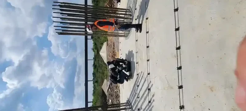
Yes. On asphalt or concrete we use a hot-glue technique to bond the geophone base plates directly to the hard surface. The coupling is actually excellent on pavement because the rigid surface transmits high-frequency energy efficiently. We do need a clear straight line of about 50 to 70 feet for the spread, which is usually manageable in a parking lot or along a street frontage.
How long does it take to get the final report?
Field acquisition on your Long Beach site takes about two hours for a standard 24-channel line. The processing, dispersion analysis, inversion, and report drafting are completed in our lab within two to three business days. We can expedite to next-day delivery if the structural engineer is on a tight deadline and the data quality is clean.
What is the difference between MASW and a downhole seismic test for VS30?
MASW is a non-invasive surface method—we never drill or penetrate the ground. It measures Rayleigh wave dispersion along a geophone spread and inverts for a VS profile. A downhole seismic test requires an open borehole and a downhole triaxial geophone lowered to discrete depths. MASW is faster and cheaper and works well for VS30 site classification. Downhole seismic gives higher vertical resolution at depth and is preferred when you already have a borehole and need detailed interval velocities for a site-specific response analysis.