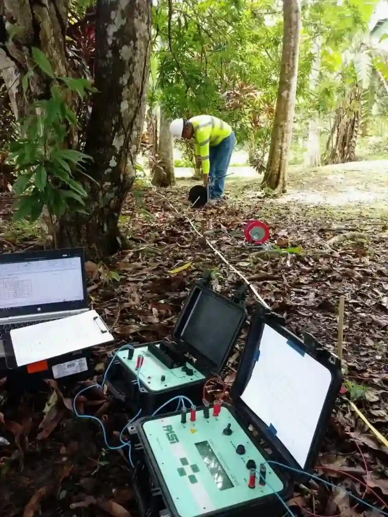
The subsurface conditions in Long Beach can change dramatically within a few blocks. Compare the dense, compacted sands around the Port of Long Beach and Terminal Island with the softer, water-charged alluvium underlying the Los Cerritos neighborhood near the San Gabriel River. That contrast isn't just academic—it directly impacts foundation design, excavation planning, and environmental risk. Electrical resistivity testing, and specifically Vertical Electrical Sounding (VES), lets us map these transitions without relying solely on invasive drilling. By injecting a known current and measuring the potential difference, we build a resistivity profile that reveals where saturated silts give way to dry sands or where a saline wedge is pushing inland beneath coastal Long Beach. For engineers dealing with the city's mix of old oil fields, artificial fill, and natural floodplain deposits, this non-invasive geophysical method is often the fastest way to connect the dots between scattered borehole data.
In Long Beach, a VES line across a proposed detention basin revealed a buried paleochannel at 55 feet depth that conventional borings had completely missed.
Local geotechnical context
A 15-story mixed-use tower was going up near Ocean Boulevard, and the preliminary geotech report flagged possible sulfate-rich groundwater at 20 feet based on a single monitoring well. The structural engineer needed to know how far that corrosive plume extended before specifying the concrete mix and pile coating. We ran three VES soundings along the property line. The resistivity profiles showed the plume was actually a narrow, confined lens migrating along an old storm drain trench rather than a widespread aquifer condition. That detail saved the owner roughly 85 linear feet of unnecessary special coating on the cast-in-drilled-hole piles. Skipping this step would have forced an overly conservative—and expensive—durability strategy, or worse, a foundation vulnerable to premature degradation. In a seismically active city like Long Beach, where the groundwater table sits high and saltwater intrusion is a known issue, assuming uniform subsurface chemistry from a single boring is a gamble no project should take.
Common questions
How deep can a VES survey reach in the Long Beach coastal plain?
The depth of investigation is controlled by the maximum current electrode spacing. In Long Beach, where we are often targeting the interface between Quaternary alluvium and the underlying Pico or Repetto formations, we typically use spreads of 400 to 600 feet, which can achieve penetration depths of roughly 80 to 150 feet. Deeper soundings are possible on large sites like those near the Port, but we must account for the strong electrical noise from the urban grid and buried utilities, which requires longer stacking times and higher current injection.
What does an electrical resistivity survey cost for a typical lot in Long Beach?
For a standard VES sounding on a residential or small commercial lot in Long Beach, budgets typically range from US$610 to US$1,200 per sounding. A 2D ERT profile with a 165-foot spread generally falls in the upper part of that range. The final figure depends on access constraints, the need for traffic control on busy streets like Pacific Coast Highway, and the required penetration depth. We provide a fixed-price proposal after reviewing the site plan and project objectives.
How does high salinity near the Port of Long Beach affect resistivity readings?
Saline pore water is highly conductive, so it dramatically lowers the measured resistivity—often below 5 ohm-meters. While this can mask subtle lithologic boundaries, it actually makes ERT an excellent tool for mapping the inland extent of the saltwater wedge. We compensate for the salinity effect by collecting groundwater conductivity samples from nearby monitoring wells or temporary piezometers, which allows us to apply a petrophysical correction (Archie's Law) and extract truer lithologic information from the inverted resistivity model.